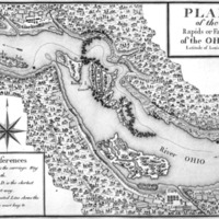
Plan of the Rapids of Falls of the Ohio, Latitude of Louisville.
Dublin Core
Title
Plan of the Rapids of Falls of the Ohio, Latitude of Louisville.
Subject
Clark, George Rogers, 1752-1818
Clark's Expedition to the Illinois, 1778-1779
Vincennes (Ind.)--History--Revolution, 1775-1783
Clark's Expedition to the Illinois, 1778-1779
Vincennes (Ind.)--History--Revolution, 1775-1783
Description
A Map showing Corn Island. In early 1778, Clark went from Williamsburg to Fort Pitt to recruit men and obtain supplies. He then travelled down the Ohio River to Corn Island at the Falls of the Ohio before proceeding to Fort Sackville. Engraved for Imlay’s American topography.
Creator
Conder, T.
Source
912.772 I93c,
Map Collection, Indiana Division, Indiana State Library.
http://www.in.gov/history/2992.htm
Map Collection, Indiana Division, Indiana State Library.
http://www.in.gov/history/2992.htm
Publisher
Indiana State Library
Date
1793
Contributor
Indiana State Library
Format
Original: Map; Digital: GIF
Type
Map
Files
Collection
Citation
Conder, T., “Plan of the Rapids of Falls of the Ohio, Latitude of Louisville.,” accessed May 17, 2024, https://gretaswain.org/sackville/items/show/9.

